Guide to the Flaming Gorge Scenic Byway
Discover Unbeatable Vistas On a Designated All-American Road
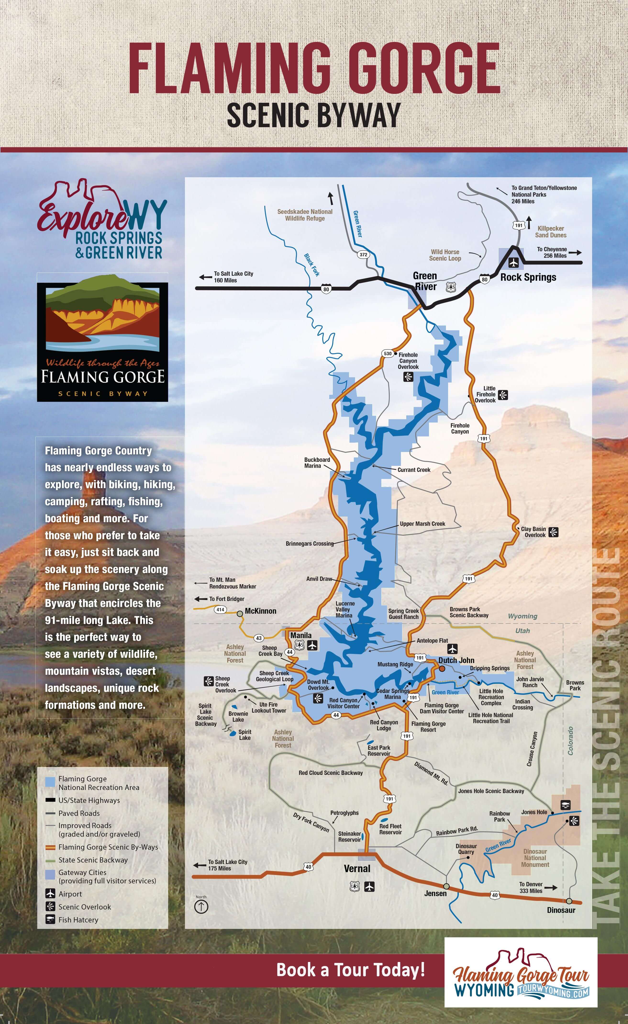
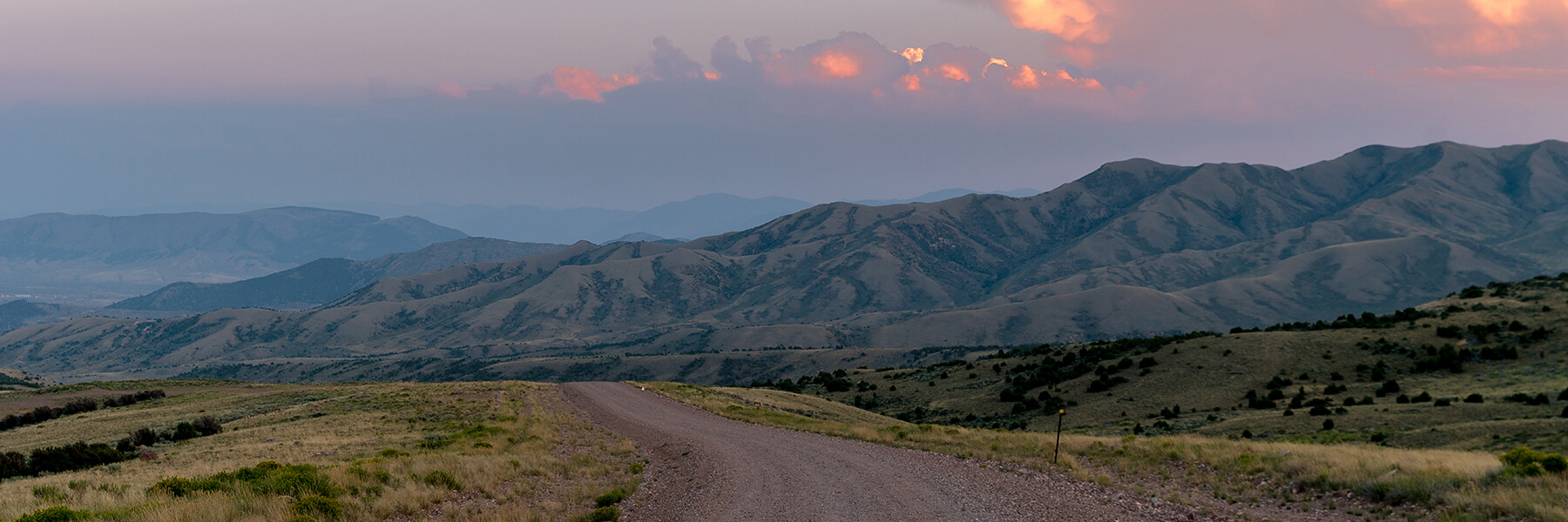
Marvel at stunning rock formations, an expansive lake and abundant wildlife on a scenic drive through Southwest Wyoming and northern Utah. One of 37 of the nation's designated All-American Roads, the Flaming Gorge Scenic Byway is a 150-mile drive starting in Rock Springs and ending in Green River. From Rock Springs, your journey begins at Exit 99 off I-80, following U.S. Highway 191 south through the high desert country. Vast and untouched landscapes unfold which are home to large herds of pronghorn antelope, wild horses, mule deer and many species of raptors.
View or download the Flaming Gorge Scenic Byway map to find all the must-see spots and hidden gems located in Flaming Gorge Country.
Please adventure responsibly and take care to keep our communities safe. Keeping your distance is easy in our wide open spaces.
Flaming Gorge Tour
With so much to see and do along this scenic drive, it can be hard to know where to start. Luckily, you can adventure with a local on the brand new Flaming Gorge Tour. This fully planned tour features stops at all the best places along the Flaming Gorge Scenic Byway and even includes lunch! You'll get to learn about the area's rich wildlife and history too. Join us for a tour this summer and leave the planning to us.
Audio Guided Tour
Take a listen to the introduction and begin your journey through Flaming Gorge Country. Download and listen to the full tour in your favorite media player. (12mb)
Introduction:
The Journey Begins:
Notable Stopping Points
To help you navigate Southwest Wyoming's All-American Road, add these must-see attractions and notable stopping points to your route.
Historic Routes
As you cross the bridge over the railroad tracks, you are crossing a major historic transportation corridor. During pioneer times, this was part of the famous Overland Stage Trail, a vital route across the Wild West. In the late 1860s, the Transcontinental Railroad was built along the same corridor.
Access Point: U.S. Hwy 191 - Mile Marker 500
Art Gallery of Time
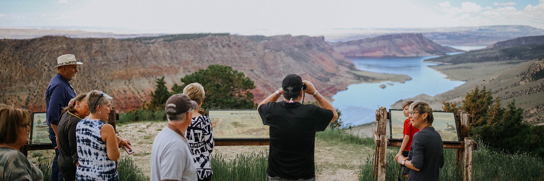
Make a stop at the Little Firehole Overlook. The interpretive sign here explains some of the vast geological forces which carved and crumbled the landscape before you.
Access Point: U.S. Hwy 191 - Mile Marker 511
Canyons and Spires and Chimneys, Oh My!
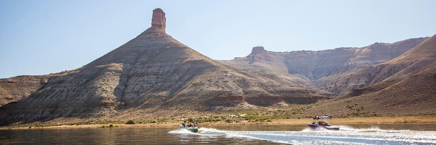
The Big Firehole Turnout is a paved 10-mile road offering the northern most access to Lake Flaming Gorge. The unique chimney formations have been carved by wind and water erosion. Big Firehole offers a boat launch, camping, restrooms and lakeside picnic facilities.
Access Point: U.S. Hwy 191 - Mile Marker 513
Birds of Prey
Several unmarked turnouts on the east side of Lake Flaming Gorge offer sweeping views of Clay Basin, where you can see more than 60 miles into Utah, Colorado and Wyoming. This area has the highest concentration of raptors (Hawks, Falcons, Eagles and Vultures) in the lower 48 states. Clay Basin also serves as a major underground storage facility for the numerous natural gas wells in the region.
Access Point: U.S. Hwy 191 - Mile Marker 535-537
Outlaw Country
At Minnie’s Gap, the road to the east travels 20 miles on paved and graded roads to historic Browns Park. Its remote location along three state borders attracted many outlaws, and Browns Park became a major way station on the Outlaw Trail. Its most famous residents were Butch Cassidy and the Sundance Kid, although a colorful list of others like Matt Warner, Tom Horn, Queen Ann & Josie Bassett, Isom Dart and Mexican Joe Herrera added to its notorious fame. Today, the charm of Browns Park is that little has changed from those frontier years, although fly rods have replaced six guns for most of its visitors.
Access Point: U.S. Hwy 191 - Mile Marker 549
Powell’s Namesake
A splendid view of the lake awaits you at this byway pullout. The colorful red cliffs across the lake inspired early explorer John Wesley Powell to name the area Flaming Gorge. Manila, Utah and Lucerne Marina are also visible across the lake. Antelope Flats offers camping, wildlife viewing and access to excellent fishing.
Access Point: US Hwy 191 - Mile Marker 401
Take a Dip!
Follow the well-marked turnoff to Mustang Ridge, a favorite boat launch and camping area. On the way is Sunny Cove, a popular lake beach for swimming.
Access Point: US Hwy 191 - Mile Marker 398
River Playground
The Little Hole Road takes you down to the most popular access point along the Green River. This day use area offers boat ramps, picnicking, rafting, hiking and trophy trout fishing.
Access Point: U.S. Hwy 191 - Mile Marker 396

Dam Good Views
The Flaming Gorge Dam & Reservoir Overlook is just around the corner on this short paved road. The waters before you are three to 400 feet deep! Many stationary boats you see are likely seeking the state's record-breaking lake trout that prosper in these waters.
Access Point: U.S. Hwy 191 - Mile Marker 395
Take a Free Tour
Don’t miss Flaming Gorge’s premier Visitor Center at Flaming Gorge Dam! Interpretive displays of the area and free dam tours can be enjoyed year round. Enjoy the newly constructed picnic facilities, boat dock and fishing pier located at the other end of the parking area.
Access Point: U.S. Hwy 191 - Mile Marker 393
Greendale Junction
Greendale Junction is the intersection of U.S. Hwy 191 and UT Hwy 44. From here, a choice needs to be made… south on U.S. Hwy 191 continues to Vernal, Utah and the land of dinosaurs. North on UT Hwy 44 leads to historic Green River, Wyoming. Either direction is packed with scenic wonders and countless recreational opportunities! For this portion of the tour, we will head north on UT Hwy 44.
Access Point: U.S. Hwy 191 and UT Hwy 44
Spectacular Views
The Red Canyon Visitor Center is located on a rocky point, 1,700 feet above the lake as it winds through this deep canyon. Stunning overlooks are plentiful here any time of year.
Access Point: UT Hwy 44 – Mile Marker 3.5
Geology Abound
Enter this 13-mile loop from either direction to enjoy the amazing views of the Sheep Creek National Geologic Area. Keep your eyes peeled for the bighorn sheep that call this area home.
Access Point: UT Hwy 44 – Mile Marker 14.5-22
Another Kodak Moment
Grab your camera and enjoy the fiery red cliffs that tower over scenic Sheep Creek Bay.
Access Point: UT Hwy 44 – Mile Marker 17.5
Pronghorn Central
Lucerne Peninsula is a great place to view these fleet high-desert mammals and is the major marina and camping development on the lake.
Access Point: UT Hwy 44 – Mile Marker 43
Hit the Water!
The historic location of Brinnegar’s Crossing is one of many unpaved roads along your journey north that offer access to more remote regions of the lake.
Access Point: UT Hwy 44 – Mile Marker 31
See that Water Tower?
It is the site of Buckboard Marina, offering the most northern marina services and an excellent ice fishing departure point.
Access Point: UT Hwy 44 – Mile Marker 24
Barren Lands
Learn more about the incredibly sculpted towers and chimneys that dominate this area of the gorge.
Access Point: UT Hwy 44 – Mile Marker 8
Expedition Island in Green River
As you travel north, you will reach the town of Green River, Wyoming and Expedition Island, where John Wesley Powell began his voyage of exploration down the uncharted waters of the Green and Colorado Rivers. Today, visitors can enjoy trails, swimming, kayaking and picnicking at this idyllic site. This is your last stop on the Flaming Gorge Scenic Byway. Stay the night in Green River at one of our hotels or lodges and eat at one of our restaurants.
Access Point: 475 South Second East St., Green River, Wyoming 82935