
Hiking
Miles of Trails to Explore in Southwest Wyoming
Hiking remains one of the best ways to get up-close and personal with the wild, Western landscape of Sweetwater County, Wyoming. Whether you are passing through en route to Yellowstone and the Tetons and looking for a warm-up, or you’re just a trailblazer looking for something new, our public land offers a variety of footpaths to explore.
Explore some of the best hiking trails and areas in Southwest Wyoming.
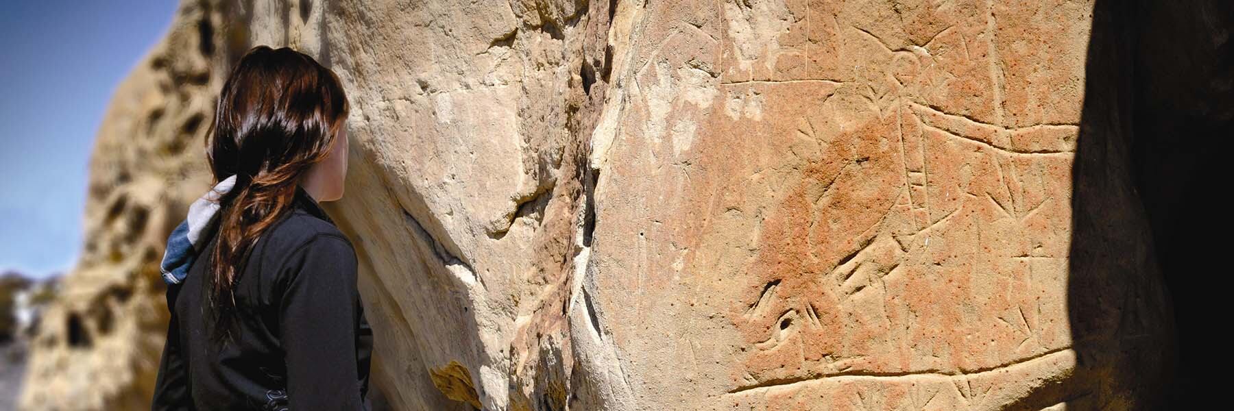
White Mountain Petroglyphs
Distance: 0.7 Miles | Difficulty: Easy
The White Mountain Petroglphys trail is a 0.7-mile hike leading to ancient petroglyphs dating back anywhere from 200 to 1,000 years ago. A short footpath leads from the road to these ancient petroglyphs from the Plains and Great Basin Native Americans. Learn more about visiting the White Mountain Petroglyphs.
Seedskadee National Wildlife Refuge
Distance: 1.07 Miles | Difficulty: Easy
Visit Seedskadee National Wildlife Refuge for hiking along with wildlife watching and fishing. Take the 1.07-mile Flicker Trail or the footpath through Hawley Wetlands for some of Wyoming’s best birdwatching. The Flicker Trail leads toward the banks of the Green River and offers a picnic area—so make sure to pack a lunch and enjoy the views! Learn more about visiting the Seedskadee National Wildlife Refuge.
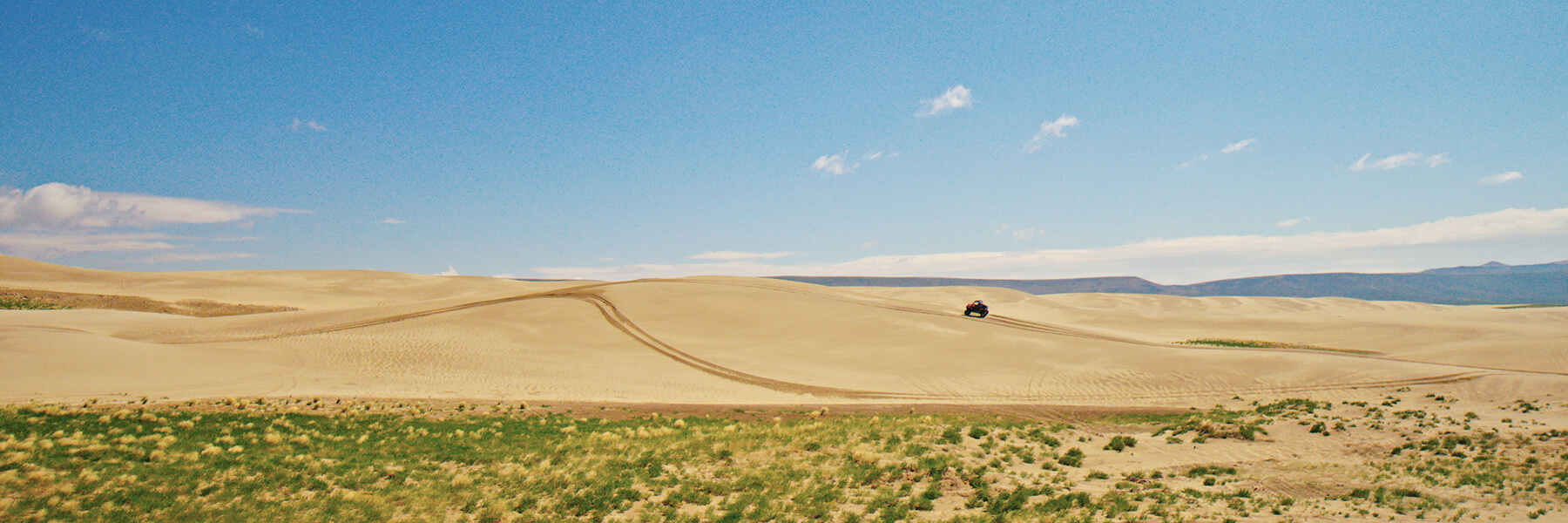
Killpecker Sand Dunes
Distance: Varies | Difficulty: Easy - Hard
No path is needed when you have acres upon acres of soft sand to explore. Hiking the dunes can range from easy to hard, with the tallest dunes surpassing 100 feet. Traverse Wyoming's sand dunes just north of Rock Springs by foot, sled or off-road vehicle. You can choose where and how far you want to hike! Learn more about visiting the world's second largest sand dunes.
Greenbelt Pathway
Distance: Varies | Difficulty: Easy
The Greenbelt Pathway in Green River is a series of family-friendly trails throughout town totaling more than 12 miles. Passing through parks and along the river, these scenic trails are perfect for walking, biking and skating. View an interactive map of the trails or download the map for more information.
Flaming Gorge Country
Distance: Varies | Difficulty: Easy - Hard
Explore the vast national recreation area just south of Rock Springs and Green River. At the southern edge of the county, Lake Flaming Gorge and its surrounding plateaus offer ample opportunity to hike and explore this arid landscape. See our top hiking picks in the area or learn more about visiting Flaming Gorge Country.
And make sure to check out more of the diverse hiking trails in Flaming Gorge Country on FlamingGorgeCountry.com. From short, quick hikes to challenging, long hikes, there is something for everyone to explore in Southwest Wyoming.